
Deeded acres are the acreage recited in the recorded deed's legal description, not the figure from a current survey, GIS map, or tax roll. That one number names what the deed says changed hands, and it can differ from what's measured or taxed today.
You're probably looking at three screens that don't agree. Your deed says one thing, the county map shows a little less, and your appraisal notice lists something else again, maybe to three decimal places. It's tempting to assume someone made an error and your bill is wrong.
Sometimes it is. Often it isn't.
Each figure comes from a different job. The deed records a conveyance, a survey locates boundaries on the ground, and the appraisal district values taxable property for a specific tax year. Once you keep those jobs separate, the numbers stop looking like contradictions and start telling you where to check first.
What Deeded Acres Actually Name
Deeded acres are the acreage stated inside a recorded deed. If you're asking what deeded acres are, start there, with the paper, not the pasture.
The figure usually sits inside the legal description, alongside metes and bounds, a plat reference, or a reference to an older survey. The West Virginia parcel acreage guide describes deeded acres as the acreage stated in a property deed, the historical legal record documenting a conveyance of real estate.
That guide also separates deeded acreage from calculated acreage, which someone produces by measuring or computing area from mapped boundaries, and from assessed acreage, which a local tax authority may use for valuation or taxation. Those are different products, even when they describe the same fence line.
Paperwork, tape measure, and tax account
Think of it this way. The deed is paperwork that names what changed hands. A survey is a tape measure on the ground. The tax roll is the quantity someone entered into an appraisal account.
A deed can recite 10.00 acres even when a later survey, a GIS polygon, or the appraisal account prints a different figure. That doesn't make the deed fake. It means the recital came from an earlier description and hasn't been recomputed.
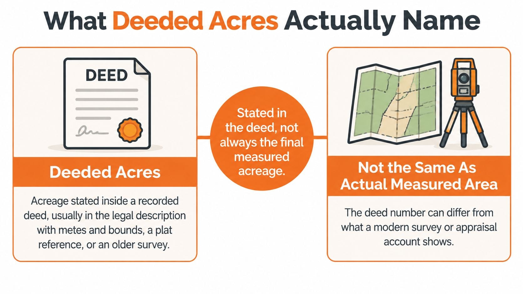
The deed is evidence of the property interest that was transferred. It doesn't promise the recited number is exact to the square foot, and it doesn't force every appraisal district to tax that exact number.
Some offices copy the deed figure onto the parcel record. Others calculate their own figure or use an assessed figure for the account. Both approaches exist, so a mismatch alone doesn't prove a billing mistake.
The deed tells you what was conveyed. It doesn't, by itself, tell you what was measured this year or what will be taxed this year.
Five figures you may see for one tract
Owners get confused because all five figures below get called "acres" in conversation. They aren't interchangeable.
| Acreage type | Where it comes from | What it controls | Must it match the deed |
|---|---|---|---|
| Deeded acres | Acreage recited in the recorded deed's legal description | Evidence of the land conveyed | This is the deed figure itself |
| Surveyed or calculated acres | Licensed ground survey or area computed from boundary calls | Boundary location and measured area | No. Closure, monuments, and later takings change the math |
| GIS acres | County parcel-map polygon | Map display, not a legal survey | No. Digitizing, roads, and water often clip the polygon |
| Assessed or appraisal acres | Local appraisal account as of January 1 | Land quantity used on the tax roll | No. Splits, overlaps, and data entry can differ |
| Qualified agricultural acres | Current use, intensity, and history tests by the chief appraiser | Land eligible for productivity value, not improvements | No. House sites and failed use tests are excluded |
The practical move is simple. Set the deed, any recorded plat or survey, and the appraisal account side by side before you treat a gap as a tax error.
Write down which document produced each number. A 0.20-acre gap between a map polygon and a deed from decades ago means something very different from the same gap between a new survey and the current appraisal account.
How Deed Language Turns into an Area
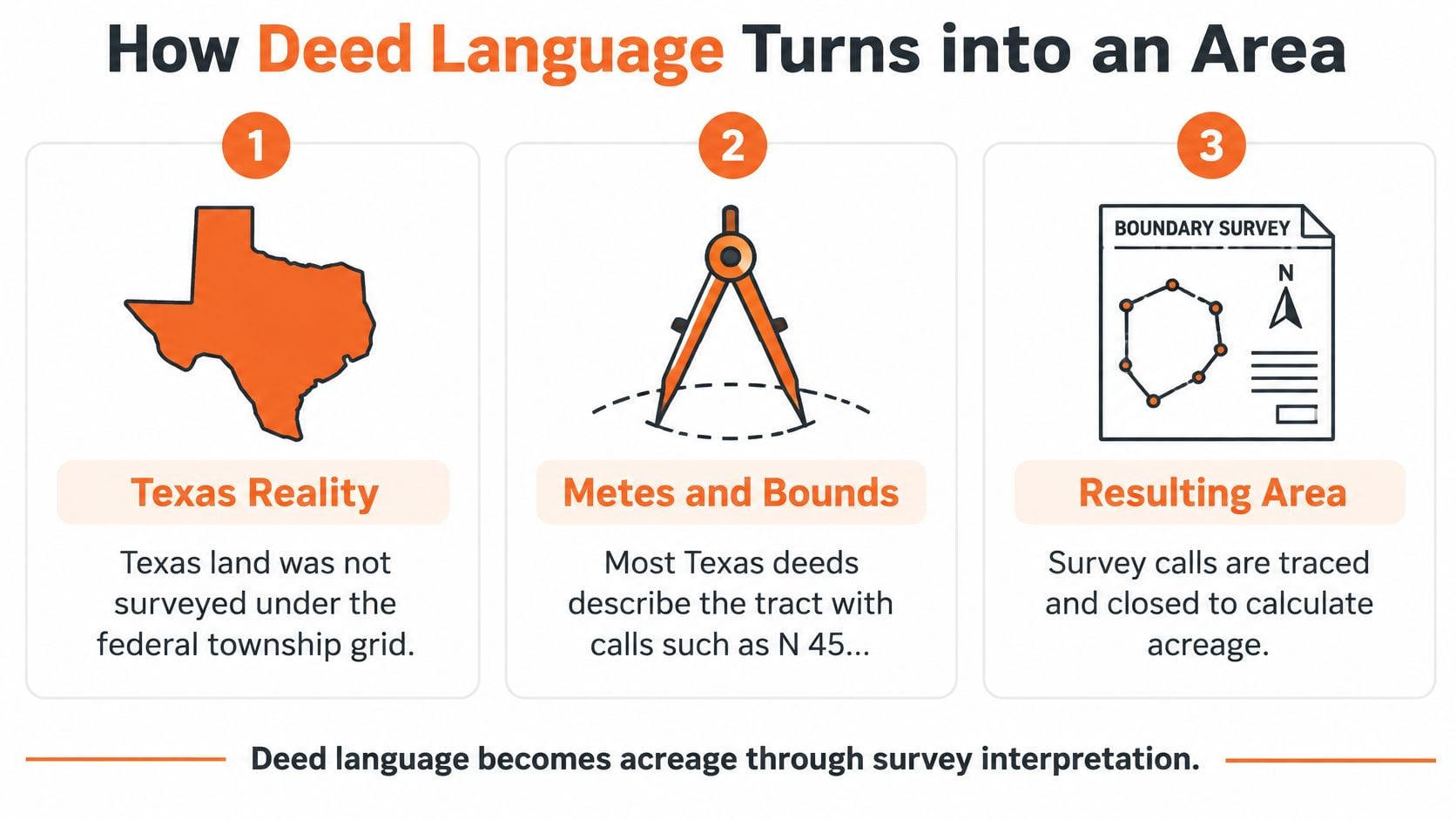
Two neighboring tracts can have deed descriptions written in very different ways. Texas deeds commonly use metes and bounds, a series of directions and distances that traces a property's boundary.
A description might list calls such as N 45 degrees E 412.6 feet, then refer to curves, monuments such as iron rods or creek bends, adjoining owners, or an original survey or land grant. Those details describe the boundary. Any acreage stated in the deed may be a rounded recital, not a fresh measurement.
Why the computed area moves
A surveyor follows each boundary call in sequence and checks whether the path closes, meaning it returns to its starting point. If an old bearing is slightly off, a monument has moved, or a creek has shifted, the calculated area can differ while the deed still says 10.00 acres, more or less.
The words “more or less” signal that the stated acreage is approximate. The deed conveys the land described by its boundary calls, while the acreage recital may not promise an exact area. To determine the area, use those calls or a current survey rather than relying only on the rounded figure.
A guide to the measurement of an acre can help make small differences easier to picture. A 10-acre tract contains 435,600 square feet, so a 0.1-acre difference equals 4,356 square feet, roughly the area of a house pad. That helps explain why a small decimal difference can still describe a substantial patch of ground.
The federal grid, for contrast
Many deeds outside Texas use the rectangular system established by the Land Ordinance of 1785. The Library of Congress history of surveying and the public land system explains that townships were six miles by six miles, covering 36 square miles, and divided into 36 one-mile-square sections.
Under that system, a section equals 640 acres, a quarter section about 160 acres, and a quarter-quarter about 40 acres. The same history gives the standard conversions: an acre contains 43,560 square feet, a mile contains 5,280 feet, and a square mile contains 640 acres.
The scale of the federal survey effort was large. The United States originally faced surveying more than 1.8 billion acres of public-domain land, and nearly 1.5 billion acres have since been surveyed into townships and sections and marked with monuments.
For a Texas tract, follow the deed's own boundary calls rather than forcing them into that grid. A description that begins at an iron rod in an original survey and follows a creek gets its area from those calls, even when they are old. A deed's acreage recital is not automatically the surveyed area, the taxable acreage, or the land that qualifies for agricultural valuation.
Why the Tax Roll Shows a Different Number
Texas appraisal districts determine property values annually as of January 1, and local appraisal records, not the Texas Comptroller, maintain parcel-specific property information, according to the Texas Comptroller overview of property tax basics. That date is the anchor for the tax roll.
Your deed may have been recorded years earlier. The roll is asking a narrower question, what taxable property existed, and how was it classified, on January 1 of this tax year.
Rolls also store acreage differently. An account may show three decimal places while your deed uses a whole number, the words more or less, or a reference to a prior survey. Precision on screen doesn't always mean someone performed a new survey.
Common reasons for a gap
A gap can come from the measurement date, a later split after a sale, an easement, a road right-of-way removed from a map, a waterway, a county-line cut, or a data-entry habit in the appraisal office. None of those automatically means the bill is wrong.
| What you see | Usual cause | Tax question to ask |
|---|---|---|
| GIS polygon is smaller than the deed | Right-of-way, water, or a digitizing clip | Is the map being treated as a survey when it is only a picture |
| Roll lists more acres than the deed | Unsplit sale, overlap, or a missed conveyance | Is land being taxed twice or on the wrong account |
| Roll lists fewer acres than the deed | Road taking, county-line split, or a separate account | Is legally owned land missing from this account |
| Roll uses three decimals and the deed uses a whole number | Appraisal data convention, not a new survey | Is the gap large enough to move value, or only rounding |
| Agricultural acres are below deeded acres | Homesite, road, or land that failed the use test | Did the class change, not just the total area |
Read the table by asking what changed. Area, ownership, classification, and map display are four separate changes that often get lumped together.
When a smaller number raises the bill
A smaller surveyed area can shrink the land component of value. It can also do the opposite.
Say a new survey shows part of a rural tract is now road frontage, a commercial pad, or land no longer used for the qualifying purpose. That portion may lose a special-use classification and move to market value. Your total tract got smaller, but your bill can rise because the class of the remaining acres changed.
The opposite error happens too. The roll may omit land that's still legally in the tract, or two accounts may overlap after a sale so the same dirt is taxed twice.
INTELLI uses licensed property tax consultants and employs a data first approach, using public and private data, including deeds, historical plats, surveys, and county records, to test whether the roll's acres match the recorded boundary. That comparison comes before anyone argues value, because correcting a sentence in a deed doesn't, by itself, change a January 1 appraisal.
Qualified Agricultural Acres Follow Different Rules
A deed can recite 10 acres, while only part of the land qualifies for agricultural appraisal. The deed records a conveyance description. It does not automatically establish taxable acres or agricultural acres, and those figures can affect the property tax bill in different ways.
For open-space appraisal, land must meet requirements set out in the Texas Comptroller agricultural appraisal guidance. It must be devoted principally to agriculture, satisfy the locally accepted intensity standard, and generally have been used for agriculture or timber for at least five of the preceding seven years.
The owner applies in each appraisal district where the land is located. If a tract crosses a county line, an application in one district does not cover land in the other.
Productivity value is not market value
Qualifying land and appurtenances may receive productivity appraisal. The house, shop, or commercial building is an improvement, so it does not receive productivity value merely because it stands on qualified land.
Productivity value reflects the land's agricultural earning capacity, rather than what a buyer might pay for it. The distinction is practical: the district evaluates what the land can earn through agricultural production, not its potential sale or subdivision price.
The land's classification can matter more than the tract's total area. If an acre moves from productivity value to market value, that change may affect the bill more than a small correction to the acreage.
Check the record, not the recital: Review the appraisal account for qualified acres, land class, use history, and application status. The deed's acreage alone does not show which land receives productivity appraisal.
There is no universal acreage threshold
The Texas Comptroller guidance on agricultural land in residential areas explains that special appraisal generally has no minimum or maximum acreage, except for beekeeping. It also describes one statutory 1-d eligibility framework in which qualifying agricultural land is between five and 20 acres.
These rules address different provisions and situations. A smaller tract is not automatically disqualified, and a larger tract is not automatically eligible. The land must still meet the applicable use and intensity requirements.
If the property has several uses, agricultural activity must be its principal or primary use under the cited guidance. A homesite, retail pad, or storage yard can therefore affect the classification of the area devoted to that use.
Local appraisal districts apply land classifications, determine typical agricultural intensity, and calculate productivity values under statutory methods. Reviewing the agricultural exemption requirements can help owners identify which tests apply before changing land use or dividing a tract.
Physical improvements do not change the deed's acreage, but they can make it important to distinguish buildings from land on the appraisal account. Owners planning farm or ranch construction can explore agricultural builders on BarndoBuilderList. A barn or equipment building is an improvement; the land beneath it remains subject to the applicable land classification rules.
A change in use can interrupt the required use history even when ownership and deed language stay the same. INTELLI handles property evaluation, documentation gathering, deadline management, and representation at hearings for its clients.
A Ten Acre Tract Told Four Ways
Say you buy a Hill Country tract and the paperwork tells four versions of the same story. None of the people holding those versions is lying. They're answering different questions.
The deed says 10.00 acres, more or less, out of an 1890 survey of the original grant. That's the number the title file carries forward as the conveyance recital.
A modern surveyor closes the calls at 9.62 acres after finding a county road took a strip along the front. That's the number a fence builder needs before ordering materials or setting corners.
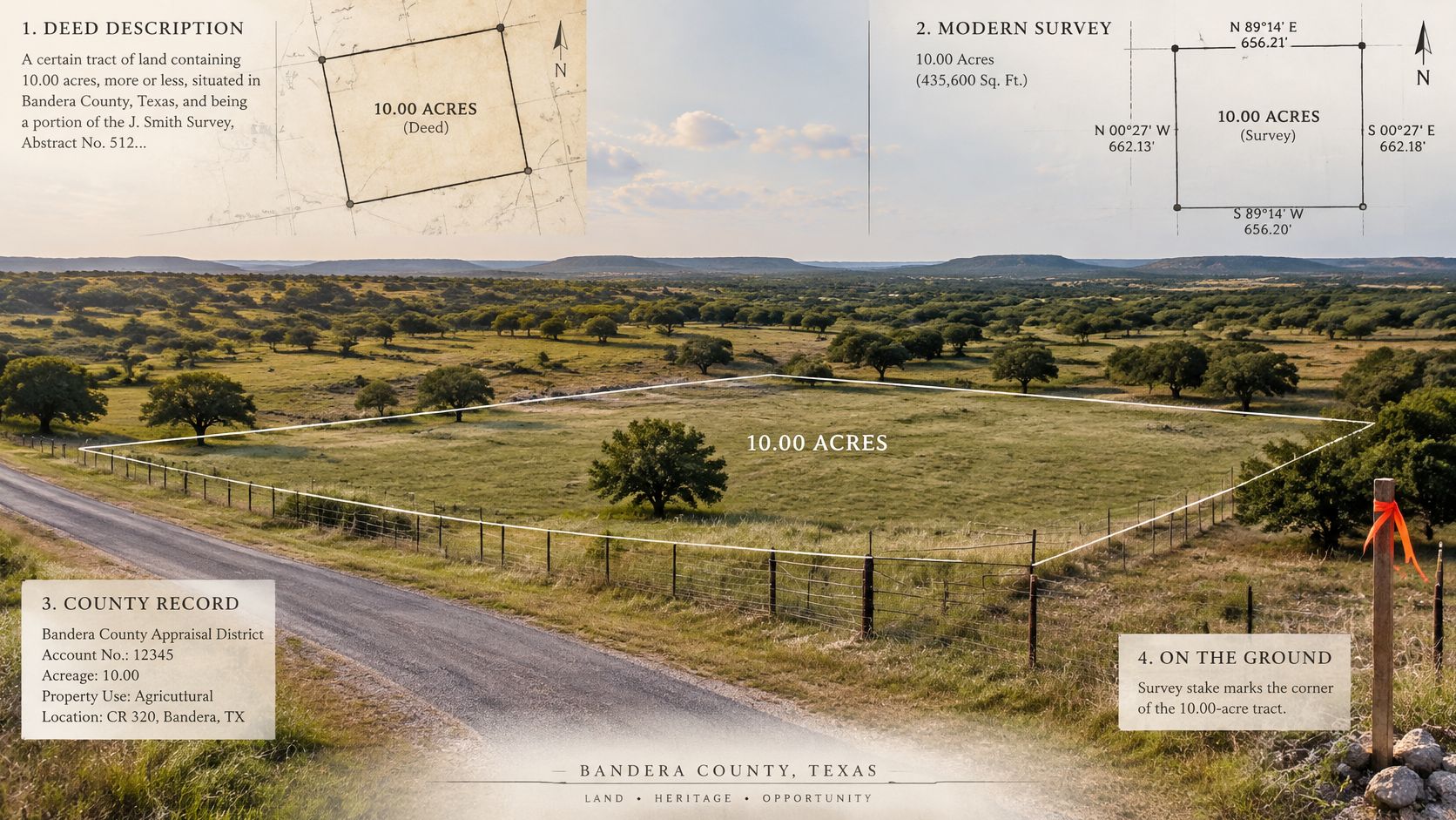
The county GIS polygon reads 9.41 acres because the waterway on the back line was clipped off the map. That's a picture for display and search, not a boundary survey.
The appraisal account lists 10.000 acres. Inside that total, 8.500 acres sit in an open-space agricultural class and 1.500 acres are the homesite at market value. That's the split that drives the bill.
Follow the 0.38-acre gap carefully
If land value was built on 10 acres and the measured taxable area is 9.62, the land component may be overstated by about 0.38 acre. But only the acres inside each class should move.
If that 0.38 acre sits inside the homesite, the agricultural acres may be untouched. If it sits in the road frontage and that frontage no longer meets the use test, cutting agricultural acres can increase the tax even though the total tract got smaller.
Putting the homesite into the agricultural class by mistake would do the reverse. It would understate the tax now and create a problem when the district corrects the class later.
The video below is a useful pause point if you want to hear the survey side explained in plain terms before you compare documents.
End with two questions: Which acres did the January 1 appraisal use, and which class was each acre in?
Reconcile the Deed Survey Map and Appraisal Account
A deed's acreage recital, a survey's measured area, and the appraisal account's figures answer different questions. Compare them in a fixed order, starting with recorded documents rather than a map. Deeded acres describe the conveyance; they are not automatically the taxable acres or the acres that qualify for agricultural valuation.
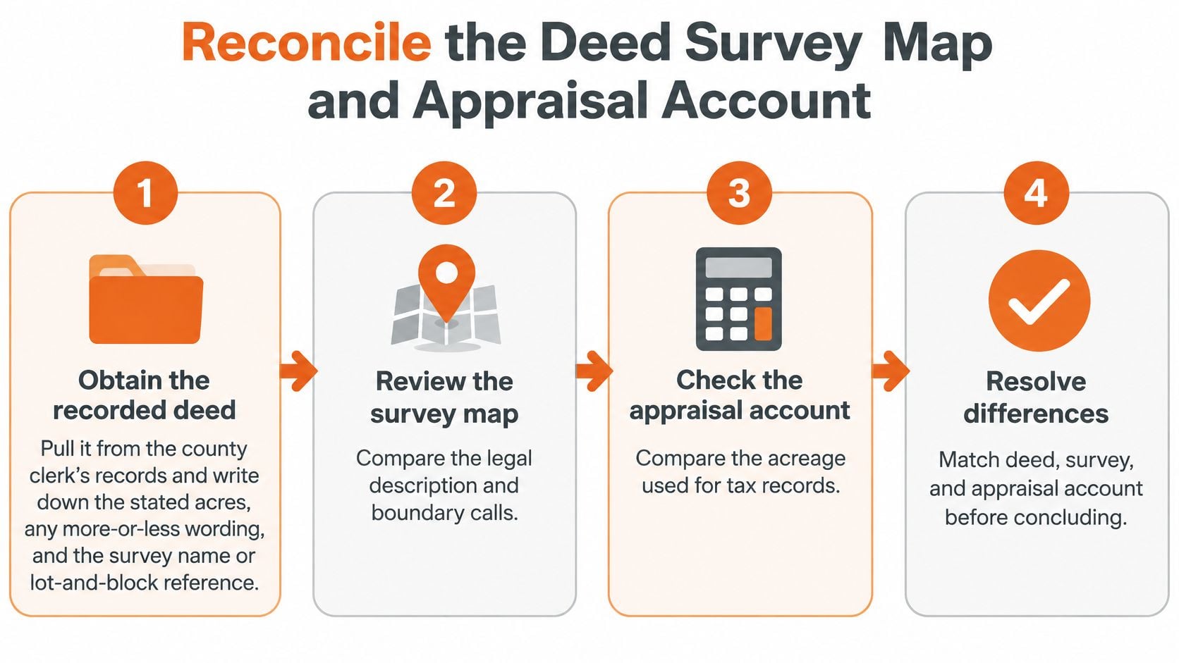
Six checks in order
Pull the recorded deed: Find it in the county clerk's records. Note the stated acres, any “more or less” wording, and the survey name or lot-and-block reference.
Read the latest survey or plat: Record the measured area, survey date, boundary markers, easements, and any land taken for roads. A survey provides boundary information that a display map may not. For help with survey orientation terms, see this guide to a base line in surveying.
Open the appraisal account: Write down the legal description, total acres, land classes, exemptions, and the January 1 tax year shown. These are the account details to compare with the deed and survey.
Check the parcel map for shape: Look for splits, overlaps, water, easements, or county lines. Treat the map as a visual reference, not as a substitute for a boundary survey.
Keep four figures separate: List deeded acres, surveyed acres, taxable acres, and qualified agricultural acres in separate columns. A difference in the mapped area alone does not establish that an exemption was lost.
Ask the district for its basis: If the account's acreage or land class differs from the deed and survey, request the records supporting its figures. Ask which acreage and class the district used for the relevant January 1 appraisal.
When the problem is title, not tax
A comparison may reveal overlapping legal descriptions or a boundary dispute, rather than an appraisal-account error. That points to an ownership issue, which may need attention before any tax record can be corrected. Texas property owners should seek guidance appropriate to Texas law. A page offering title guidance for Kona property owners concerns Hawaii property and does not explain how to resolve a Texas boundary dispute.
Different acreage figures do not necessarily mean someone made an error. Texas appraisal data can record acreage to three decimal places, while a deed may use approximate acreage, older metes-and-bounds language, or a reference to a previous survey. Survey dates, boundary changes, easements, road rights-of-way, parcel splits, and data-entry conventions can also account for a difference.
Correcting the deed's acreage recital does not automatically lower the tax bill. A smaller measured area may reduce the taxable land quantity, but it may also mean some land no longer qualifies for agricultural valuation. Check which acres and classes the appraisal account uses before treating a mismatch as a tax correction.
Decide Whether the Mismatch Is Worth a Protest
Use one test. Does the mismatch change the land quantity or land class used on January 1?
If the deed, survey, and roll disagree, but the quantity and class on your notice match how the property was used on January 1, it's a records note. Keep your worksheet and monitor next year's notice.
If the roll's acres or class would change market value, or would remove a homestead, over-65, disabled-person, disabled-veteran, or agricultural valuation, file a documented challenge before your local protest deadline. That's a bill problem, not a paperwork curiosity.
In the ten-acre example, a 0.38-acre gap inside the homesite class is probably a records note. Losing agricultural class on road frontage that fails the use test is a protest case because productivity acres become market-value acres.
Keep the deed's acres as your ownership clue. Treat the appraisal notice as the figure that drives this year's bill.
For Texas home, rental, or commercial parcels, INTELLI uses licensed property tax consultants and employs a data first approach, using public and private data, to compare the deed, survey, and appraisal account before any filing. INTELLI helps property owners in Texas reduce their property tax bills, handles property evaluation, documentation gathering, deadline management, and representation at hearings, and does not charge customers if it does not lower their property taxes.
Line up the four acreage figures first. Seek representation only when the January 1 land quantity or its classification is what inflates the bill.
If your appraisal notice uses acres or a land class that your deed and survey don't support, bring those records to INTELLI for a data-first review before your protest deadline. We'll compare the recorded boundary, qualified acres, and January 1 account, then handle the evidence and hearing if the mismatch is inflating your Texas property tax bill.